 Things were shaping up perfectly for the annual Turkey Burner ride at Douthat State Park this year. A forecast of temperatures in the 60s combined with a nearly cloudless sky and quick-draining trails meant that the rainfall earlier in the week likely wouldn’t be much of a factor. Not true for the trails closer to home.
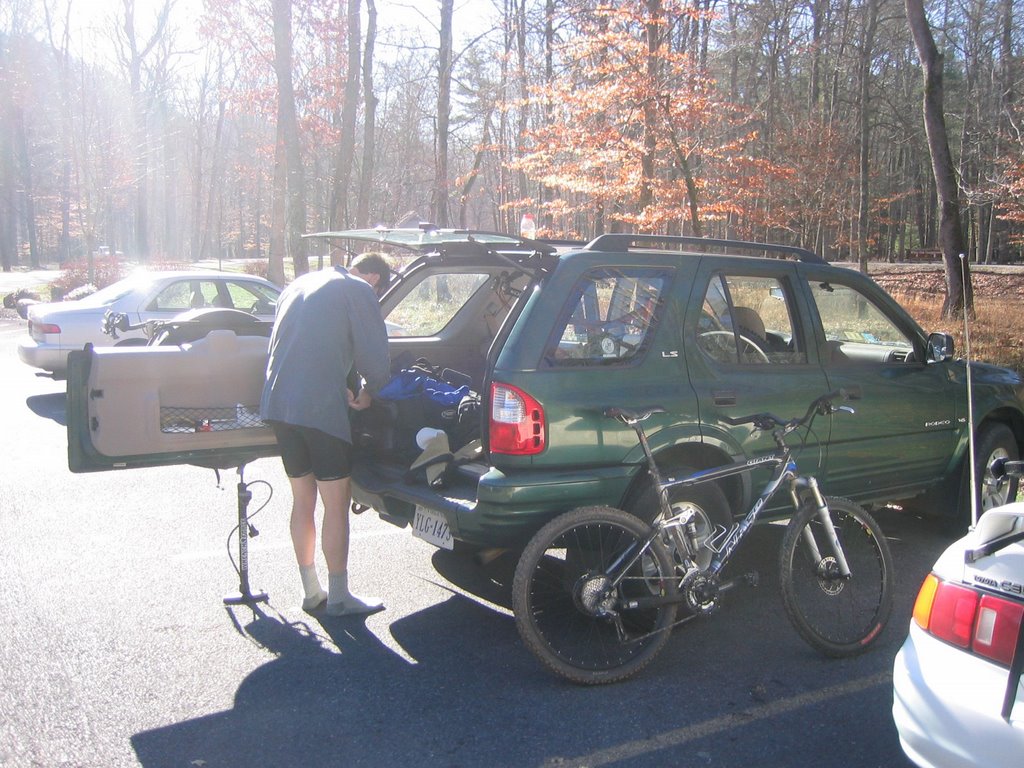 It’s the morning of Black Friday, that day of vapid spending when oblationary plastic cards are offered up to the gods of mall things in exchange for largesse in a ceremony that incongruously equates bounty with love. I roll out of bed and dress quickly. In the kitchen of the home where I’m staying, I nuke up a huge bowl of gruel fuel: rolled oats and whey protein topped off with dried blueberries and cherries, with a pack of energy gel swirled in to further sweeten the mix. It’s tasty, filling, and packed with plenty of long-lasting complex carbohydrates, something I know I’ll need a lot of for the climbs that are already calling out to me over the mountain tops some 30 minutes away. It’s the Thanksgiving holiday, and I’m staying in Covington, Virginia, a quiet farming community nestled on the gentle slopes of converging mountains that rise helter-skelter from the valleys like the hulking backs of so many dozing dinosaurs. The scenery is still beautiful this time of year, even if most of the trees have long since dropped their leaves.
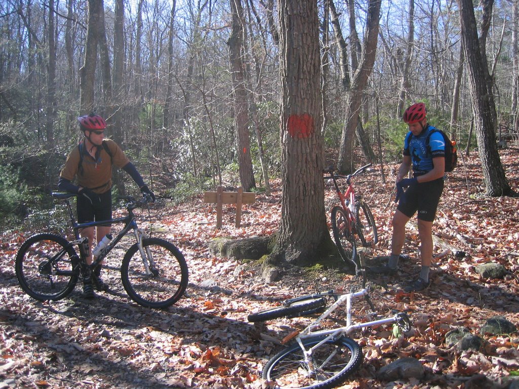 I head out to the car. It’s 9:30, and the sun has burned away any lingering morning haze. Already I feel the warmth bleeding in that will soon bring on that ineluctable sweat spot between hydration pack and back on the snaking climb to the ridge line. I fire up the engine and pop in Ben Harper’s Both Sides of the Gun, punching up "Serve Your Soul." Three days before the Wild Man's posthumous birthday, it's a fitting tune that manages to get the mood right.
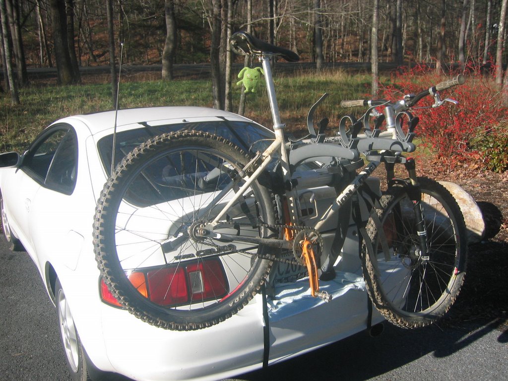
 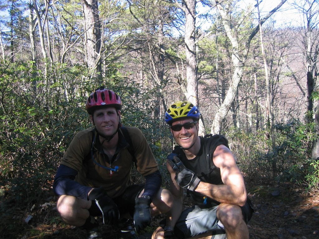 The trip to the park goes quickly. It's early enough that traffic isn't an issue, and the Celica carves the sweeping curves with the sureness of a roller coaster car. I pass through the entrance, park, finish dressing, and sit back to wait for John-o and (John) Sellers, who are running late. They're coming all the way from Smith Mountain Lake, a drive that's about three times as long as mine. Finally they pull in, and it isn't long before we're planning a route. A group of three other riders rolls up, and we shoot the shit before saddling up and heading out. The initial plan is soon scrapped in favor of another that has us starting up the Stony Run Trail. The first part of the trail is a gentle grade over choppy, washed out terrain. Clumps of matted leaves cluster around rocks in areas where the trail has suffered runoff damage. The ground is moist, but not wet, and rocky, and though the climbing is easy, the going is rough. Still, it's a warm-up of sorts, something I need to thwart an early blow-up, and I'm grateful for it.
 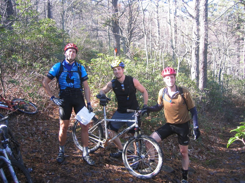 We come upon and pass the other riders, who somehow ended up on the same trail and seem to be having a tough time of it. We cross several creek branches and arrive at the first trail intersection, where John-o and I shed a layer, knowing what's coming. To the right, the Locust Gap Trail gradually winds up and bends left, slipping out of sight around the belly of the mountain. The other riders catch up to us. We decide to stay on Stony Run and begin making our way up a steeper grade to Stony Run Falls. We leave the other riders behind, until John-o stops at a water crossing to wipe fog from his glasses. I pass him and roll through the shallow stream behind Sellers, keeping the momentum going up the long climb until we arrive at the falls, where we stop to wait for John-o. A minute later, John-o rolls in just behind one of the other riders, who seems hellbent on proving he can keep up with us. We waste no time in starting again, mentally gearing up for the endless series of switchbacks that make up the remainder of the Stony Run Trail.
 The climb is interminable. The thin ribbon of trail is layered in dry leaves, threatening a momentum-killing spin-out each time torque and mass are out of kilter. Where the leaves give way, shale flecks the dirt, smooth and frictionless. I find myself standing almost the whole time, dropping down onto the saddle only briefly when the trail feigns a level stretch or the rear tire begins to slip. I stay within a few bike lengths of Sellers, who's glued to the saddle and spinning at a low but steady cadence. He seems fresh and strong and unbothered by the grueling ascent. At one switchback, I all but crash into him as he flubs the tight turn. I give him a push with my hand, hoping he doesn't stop because I might do the same, and he rolls on, setting the pace anew. It's a war of wills—him wanting to break away and me wanting just as badly to keep up—that keeps us both turning over the cranks on this 4.5 mile push to the top.
  Eventually we come to the intersection where the Tuscarora Overlook Trail breaks right and descends to the titular crag. Sellers and I stop and exchange pats on the back for our respective climbing performances. Again, the other rider shows up first, followed by John-o, who lets on that he got in a little trail running the day before and is now paying the price for it. We break out the trail food. I wolf down an energy bar and a banana. We talk for a few minutes, and the other two riders finally show up, huffing and puffing like magicless dragons. We decide to eschew the overlook trail to continue the climb to the ridge.
 I feel good and reasonably strong, something I chalk up to the last three months of commuting every day on the fixie. The air has warmed up considerably—what a difference from last year, when predawn temps were in the teens. It feels doubly sweet, this idea of riding away the day knowing that millions of people are glutting the malls nationwide like slack-jawed zombies in search of b(a)r(g)ains, when the best bargain going is a two dollar park entrance fee and a hard earned view of the surrounding valleys and peaks.
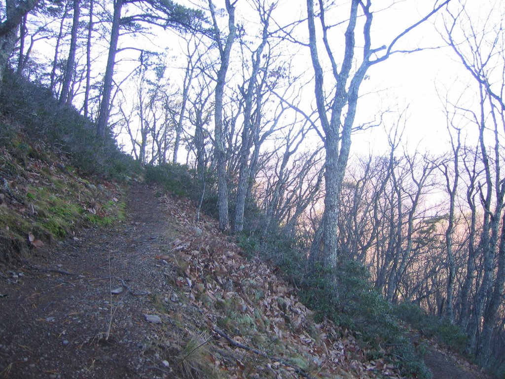 Back on the bikes, John-o takes the lead with Sellers on his wheel and me bringing up the rear. We're on the Middle Mountain Trail, and the path takes a more direct route up the mountain now, bringing with it the requisite steepness. I drop behind some, content to just maintain momentum at my pace, having surrendered the battle to keep the other two in sight. The pitch and terrain here are such that any attempt to tag along closely would mean blowing up sooner rather than later. Loose leaves overlay looser rock, and it’s tough going for a while. The others gain ground ahead of me, slipping away from my field of vision as the trail meanders through the trees. These boys are strong climbers, and today is no exception.
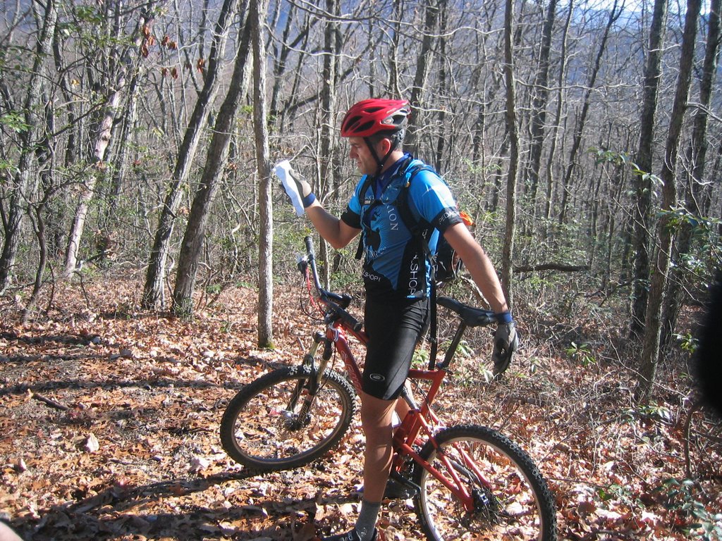 We continue climbing, and eventually I see the other two again, and begin trying to cut the distance between us. Near the ridgeline, as I come upon them, Sellers dabs on a spot where the trail is pinched out by rock slabs on either side. We briefly pile up in a jam as we negotiate the obstacle. The trail dips just outside of the boundaries of the park proper now, and we pedal past a hunter who stands at the trail’s edge, rifle in hand, scanning the skeletal copse for game that the three of us have likely sent running. The trail soon bends back into the park area, and we pedal on, breathing easier as the pitch flattens.
 We traverse the ridge on the Middle Mountain Trail, which rises and falls by turns, but maintains a comparatively straight trajectory. The scenery is unbeatable, the air is crisp, and the valleys below us fan out in all directions like the threadbare pieces of a patchwork skirt. I'm renewed by the prospect of the impending descent. It's a long stretch of super fast, off-camber singletrack over leaf litter so thick that the trail disappears beneath it, resurfacing only at the barren switchbacks, where a lapse in attention shows you the quickest way down the mountain, stopping only at Columbia Allegheny Regional Hospital in Low Moor if you're lucky, or the Nicely Funeral Home in Clifton Forge if you're not.
 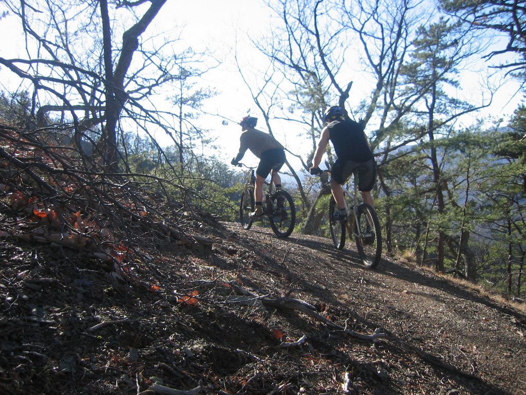 We reach the intersection where the Salt Stump Trail meets the one we're on. We take a short breather, then hop on this new trail, which starts us barreling down some of the sweetest singletrack you'll find within 4 hours of D.C. I've stowed the camera now, knowing there won't be any stopping for the next three miles or so of riding. The trail remains carpeted in a plush layer of dry leaves, and I trust the sussy fork I threw on the bike on Thanksgiving day to overcome anything immovable I might encounter beneath the pillowy hummocks. The leaves are so dry and slippery, it's almost like riding on ice chips, and they hide the trail for most of the descent. The intuitive strategy of drifting to the upside when the trail disappears has its limitations. Too far above the trail line and the front wheel wants to wash out and send bike and rider on a power slide that breaks into a culo-sobre-cabeza roll down the mountain side.
 The descent is fast, rewarding an hour plus of climbing with about five minutes of adrenaline-fueled euphoria. We rocket down the Salt Stump Trail and stop abruptly at a point where it meets the Pine Tree Trail, another leaf strewn section of singletrack that promises even faster speeds. We check the map and all agree that we should head right on the new trail to extend the bliss. Sellers sits down and busts out a pummeled PB&J sandwich. It disappears in seconds. I eat another energy bar and have a few sips of water; John-o does likewise. We discuss the dry-slick trail conditions and gloat over our good fortune to be here, enjoying this kind of ride on this kind of day. Soon, the three riders we left behind appear. They've been tailing us, albeit from a distance. We all talk for a while, discussing route options. They choose to continue on the shorter ride down the Salt Stump Trail, and we leave them then. In a second we careen down this new section in the same rider order.
 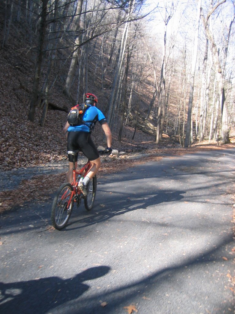 At the next fork, we hang a right on the Pine Tree Trail and continue plummeting until a hard left lands us on the Middle Hollow Trail. From there, we roll along until the aptly named Laurel View Trail appears. This trail is a mostly moderate cul-de-sac of sorts, with a short, steep climb near the midpoint of the arc over the water-swept dregs of the recent storms that ravaged the area. The arc gives way to a moderate downhill that dumps us out with a right onto Huff's Trail. We ride Huff's Trail, descending to the point where it joins the Blue Suck Falls Trail, a wide swath through the trees that, judging by the debris deposited along its wavering course, acts as a runoff magnet during heavy downpours. Speed is the ticket here; it compensates for imprecise handling and keeps the bike upright over the isles of leaves and loose rock, gnurled roots, and driftwood that blur the bounderies between trail and surrounding terrain. The Blue Suck Falls Trail is the final leg of this extended loop. It drops us off just down from the ranger station, where we parked earlier. On the paved section back toward the cars, John-o feels the need for more dirt time and Sellers is up for it. We've done almost 12 miles at this point, and I have to take inventory of the amount of ass I have left for another loop. John-o assures me it'll be a quick pass, and I sign on.
 We arrive at the ranger station, roll past our cars, and hop up on the slat bridge that is the start of the Beards Gap Trail, an old favorite from the original Turkey Burner ride some five or six years ago. The trail on this side of the park is damp and clammy, and I notice the temperature change almost immediately in the shadow of the mountain on our left. We cross back and forth over the same stream a half dozen times, sometimes riding it when it seems sure, sometimes walking it when the drop is sketchy and the price of failure is too high. Soon the stream drops away behind us, and once again we are climbing. The zig-zagging ascent is steep, a condition arising from the short, closely-spaced sections. They terminate in the tightest of switchbacks, where any error in balance means a front end flop and a dab. I suffer my share of these, as do the other two, but I make up the lost time by hammering out the straights. Near the top, a look down over the side reveals four or five segments of switchbacks, seemingly perpendicular to each other but on different planes. Of course it is only an illusion, this right-angle geometry, a cheap trick to gratify the legs and lungs.
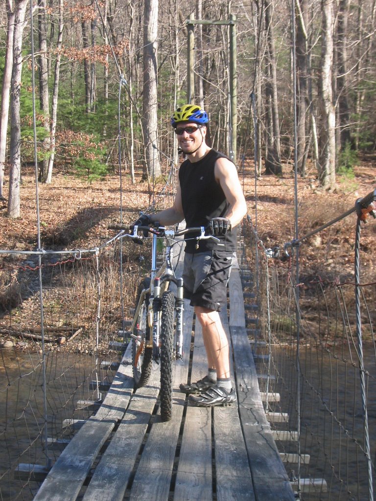 We make our way up slowly, pausing at the top where the trail ends near a kiosk at the junction with the Brushy Hollow Trail. The others arrive there before me; I've stopped along the way to fumble with the camera, whose battery has been feigning death for the last half hour. We regroup, then head right to climb up the new trail. As always, the switchbacks become longer stretches that take a more direct line up to the ridge. I'm feeling it now, but muster the will to stay on the pedals and grind it out. It isn't long before we hit paydirt, another series of leaf-ridden switchback descents even steeper than the earlier ones. I roll these with all the speed I can gather, until poor judgement has me taking the high side a bit too high in an effort to stay on the buried trail. The front washes, the bars clip the earth like an outrigger, and I tumble along the slope in line with the trail.
 I brush myself off and get back on the bike. The wheels gather speed anew, I lose the trail line and end up overcompensating again, with the same result. It's an ugly way to get down the mountain, and one I take pains not to repeat again, laying off the brakes and focusing on control and flow. In the meantime, I've lost the other guys, who seem to have landed on a successful strategy from the very beginning. At the bottom, the trail gets choppy and vague, leveling off near a creek. I follow it as best I can, until I see Sellers and John-o through the trees on the other side of the water. I ride over to a cabled suspension bridge, hike the bike up the steps, and proceed to ride about a third of the way across it until its sinusoidal motion causes me to waver and dab. Getting back on is like trying to bike a wave, and I end up walking to the other side.
We finish up on the Flat Run Trail that leads to the ranger station, running parallel between Route 629 (the main park road) and Wilson Creek. It's a scrappy makeshift path over construction-like conditions, the poor man's alternative to the asphalt on the left, and an unworthy finish to such a majestic couple of loops.
 Back at the cars, we rack the bikes before motoring down the way we just came to a lot near the outskirts of the park boundary, where the celebratory beer begins to flow like, well, like wine. From there, the boys decide to tail me to Cucci's in Covington for a little post-ride pizza. All in all, we managed a little over 18.5 miles traversing the mountain biking dreamland that is Douthat.
 And I'm due back bright and early in the morning to ride it some more with my girl. Lots to be thankful for.


2 comments:
Awesome write up... maybe next year i can make it. i love that park... and i need to get my revenge on Brushy Hollow.
Nice post, sounds like you all had a good day of riding. I bet the beers afterwards hit the spot...
Post a Comment